In the words of the late Tupac Shakur, “It’s an East coast - West coast thang”
AKA: Where the
hell have MikeAng and RussellW been?
AKA: Coast to coast with the wind
in the wires
AKA: Mike’s open cockpit
adventure
AKA: The most expensive, least
efficient way to cross the country.
AKA: How I know I’m luckier than
JFK, Jr
AKA: Read this and you’ll
understand why Sarah didn’t come with me!
By Mike Angiulo
Disclaimer – none of the pilots mentioned in this story broke any aviation laws or regulations in the course of this trip. If any part of this story suggests that we did, well that part of the story is completely fictional.
A moment to remember…
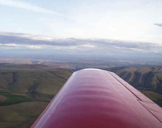
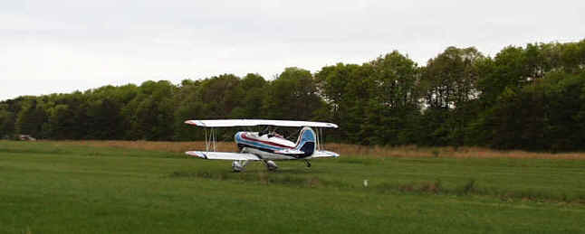
I felt very alone. The screaming noise of the engine was drowned out only by the 120mph wind buffeting my head around in the open cockpit of my new biplane. Things wouldn’t be so bad if I could see more than a hundred yards though. My left hand was busy holding my brick-sized GPS right above my heart. An inch lower and it loses reception. An inch higher and it might blow right out of the cockpit (probably finding a way to whack me in the face no doubt). The GPS is the heart of my entire avionics package as the onboard radio doesn’t work and the handheld backup radio I brought was bouncing around the floor of the cockpit. It had flown out of my pocket and was now happily trying to lodge itself in between the control stick and the rudder mechanism. In any other situation I would have picked it up but I was only 350 feet above the water (three inches below the dropping cloud layer) and I was afraid to let go of the stick for even a second because the plane was so badly out of rig that it required constant stick and rudder pressures to remain level. The GPS was the only thing helping me navigate the outer ring of JFK International’s airspace – a 25 nautical mile ring that forces you out to sea and back unless you want to talk to some busy and impatient air traffic controllers (that presupposes, of course, working communication equipment on the airplane). I actually laughed out loud when I realized that it was JFK’s airspace that was forcing me out to see in some very ‘JFK Jr. – like weather! "Just 30 miles to New Jersey," I thought. Maybe the visibility is better there. Can’t tell for sure because I’m too low to reach “Flight Watch” federal weather services. Damn feds – never there when you need them, but around all the rest of the time. I spy a lone boat in my downward cone of aquatic visibility - too bad it isn’t an aircraft carrier! Oh wait, that wouldn’t really help me, as I’ve never actually landed a plane like this before…
Out of the mist I barely discern a line. Land? I’m happy like a Pilgrim to see shore. I mean, hey, I never thought anyone would be this happy to see New Jersey. Thanks to Garmin I’ve inched my way out of a real jam. I hit the NRST (nearest airport) button and navigate myself directly to the first landing strip. It was the most beautiful strip I’ve ever (barely) seen. I manage to squeak out my first solo landing in the airplane (no pressure of course) and roll to a stop on the taxiway. I must be living the good life because just the very same moment that I squeak to a stop I hear a beep. I see the flash of “Battery Low” just before the GPS goes black.
How did this all start?
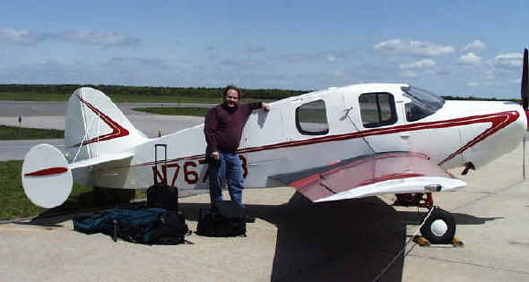
I used to own a twin engine Cessna. It seated 5, had fully redundant charging & vacuum systems, retractable gear, full IFR avionics and onboard oxygen. It was set up to do thousand mile legs nonstop at upper altitudes through weather. The only problem was it was such a complex airplane that it took constant maintenance. Fix it, fly it. Fix it, fly it. And then, with all the planets aligned perfectly, it could go half as fast as Alaska Airlines on four times the cost. Not a very good equation. When you combine that with the fact that my wife hates turbulence I decided to put it up for sale and go find myself a fun-flying biplane.
I ran some ads, and met some possible customers but one really stood out. A guy named Art who lives in Long Island, NY called me up. See, he’s an airline captain and is looking for a more practical plane. He wants a classic Cessna twin to restore and in trade offered up a very nice Great Lakes biplane. Talk about killing two birds with one stone! (Actually, in this case that’s a pretty bad expression, but I digress)
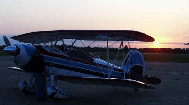
The Great Lakes was originally designed in the 1930’s and was sold up to WWII. It had either a round or an inverted inline engine and was generally regarded as a sweet flying aerobatic plane. The company went out of business and a production run was re-started in the late 70’s. The 70’s model planes were built exactly like the 30’s vintage except they had new, off the shelf, flat-four aircraft engines and constant speed propellers like you’d find on a garden variety Cessna. They were then equipped with inverted fuel and oil systems and airshow smoke systems to increase their show potential. The sturdy airframe design was once a popular fixture at airshows and has never once failed in flight or been the subject of a single structural airworthiness directive. I was pretty excited to have something this capable, this gentle and in the end this pretty. There is at least one other Great Lakes in the Seattle area that I know about but that might be it. Their relative scarcity adds to the appeal.
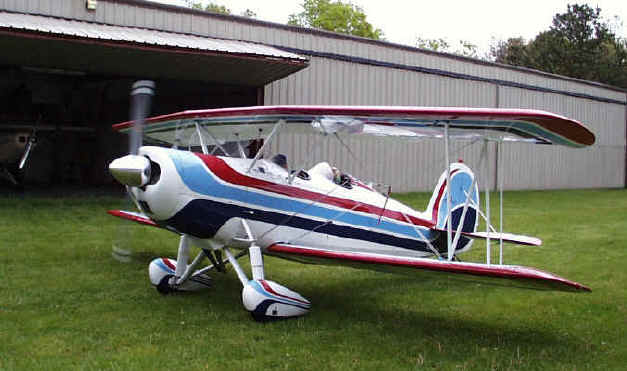
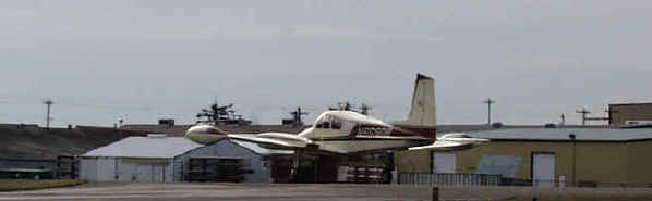
We looked at each other’s planes and made the trade. He flew himself out to pick up my twin Cessna and flew it back to NY. That flight took him two days and he had to end up using the IFR capability to shoot some approaches through weather. Now all that was left was a trip out for me to learn how to fly the Great Lakes biplane, and fly it home. Russell offered to fly me out there in his Bellanca Cruisemaster (a four seat single engine cruiser). His plane would serve the much-needed role of luggage support on the way back because the Great Lakes has no real baggage capability. He also served as a needed airborne radio-relay platform because of the limited transmitting range of my handheld transceiver.
The trip to get it
Heading out to NY to get the plane was something of an adventure in itself. Russell’s plane is comfortable and relatively fast (160mph) but even though Russell and I are both instrument rated, the Bellanca wears its classic VFR instrumentation with pride. That means we’d have to be able to fly around, under or over any weather we encountered.
By the time we reached New York we had been incredibly
lucky with respect to weather. We
missed bands of thunderstorms, a tornado and softball sized hailstorms by only a
day. The scariest part I think
though was the two times when the engine suddenly quit after running one of the
fuel tanks too low. I’ve never
seen Russell move so fast as when he lunged for the emergency fuel pump and
started twisting valves! That
deafening silence lasted only a moment but the adrenaline stayed with me for
hours…
Monday 5/8 – Day of little progress (or: a fortuitous delay)
Renton, WA (RNT) -> Walla Walla, WA (ALW)
We were supposed to leave early Monday morning but Russell’s
airplane needed some last minute maintenance signoffs. We didn’t get off the
ground until late in the afternoon and basically set the trip schedule back by a
day before we even got started.
The plan was to head east (obviously) but Steven’s pass
was socked in with clouds. We flew
south to the Columbia gorge – the Pacific Northwest ‘escape route’ to get
out of the clouded box formed by the Cascades and the Siskiyous. We found our way to Walla Walla as it started to get dark.
We tied up the plane and found a hotel.
Hmm, let’s see, one day down, and we’re a solid four-hour drive from
home.
The only interesting thing that happened in Walla Walla was the taxi driver we met. See, the taxi in Walla Walla (I use the singular for a reason) is a blue Chrysler driven by an ex-military guy who lives in Alaska during the winters. He shared with us some very valuable information about how a .50 caliber magnum won’t always penetrate the skull of an angry bear. I also learned that if you come across some “No trespassing” signs posted around a cabin in Alaska, that really means NO TRESPASSING.
Tuesday 5/9 – The weather and those beautiful Rockies
Walla Walla, WA (ALW) -> Pullman, WA (PUW) -> Twin Falls, ID (TWF) -> Scottsbluff, NE (BFF)
We called the cab to leave for the airport and, well, he
was still wearing the same clothes. He
had some pretty good jokes to tell but I can’t really print them here…
The next ‘leg’ of the trip wasn’t very fruitful.
We took off to try to cross the Rockies but were again thwarted by a
cloud layer. We couldn’t squeeze
under so we tried to go over it. We
ended up climbing to 12,500 feet, which is the highest we could go before we
needed to be on oxygen, and attempted to pick our way through the cloud tops.
We ended up flying into an ‘area of reduced visibility’ (it would be
illegal to have flown smack into a cloud) and had to turn around.
The GPS trail we left was a funny winding line that accurately mapped out
the outer edge of a giant cloud deck. We
tried going south and we eventually landed at Pullman.
Not bad – middle of the second day and now we were about 3.5 hours from
home.
After waiting for the weather to change (note: I didn’t say ‘clear’) we fired off again to Baker City dodging thunderstorm cells, then pressed on to Boise. Boise had a single, giant, black, angry thunderstorm right over the city. It was so severe that commercial airliners were being vectored around it. We decided to follow suit. Eventually we set down in Twin Falls in the nastiest, gustiest 40 knot crosswind I had ever seen. Russell valiantly keeps the oily side down and the pointy side forward in the landing but I was wondering to myself how would I possibly deal with this kind of weather on the way back in an airplane with less visibility, lower wing loading, and with nearly zero experience in type?
The next leg took us to Rock Springs, crossing the last high range of the Rockies and the last of the thunderstorms for a while. We originally planned to land at Laramie but realized that we had crossed a time zone and didn’t know it. Would you believe that our top of the line Garmin GPS’s, which tell you your position on a map by decoding satellite time, don’t automatically adjust for time zones? Garmin needs some more program managers…
This realization left us with an extra hour till sunset so we continued east to Scott’s Bluff. We had crossed the entire width of our first World Aeronautical Chart and I enjoyed realizing that we had now knocked “one WAC off” our journey. I said “WAC off.” Heh heh.
The waitress at the restaurant hated everyone. According to her the people at the front desk were snobs and the manager was a real jerk to give her a hard time about moving her car under cover during last night’s giant hailstorm. Hailstorm? It seems that we had missed by exactly a day massive hailstorms (described as flying oranges) and even a tornado. I guess getting held up in the maintenance shop on the way out wasn’t so un-lucky after all!
The only point of interest in the whole area was the VOR airway antenna named “Crazy Woman.” Things can get pretty boring over the plains.
Wednesday 5/10 – Droning across the Midwest, the Toledo debacle
Scottsbluff, NE (BFF) -> Aimes, IA (AMW) -> Toledo, OH (TDZ) -> Youngstown, OH (YNG)
Ok, so one thing became totally apparent as we droned along across the Midwest. America is empty. Totally empty. Anyone who tells me that we’re running out of space for landfills needs to go flying more often. We saw mile after mile of just nothingness (which wouldn’t compare at all to what we saw in Texas on the way back). In the entire day we received just one traffic advisory from Air Traffic Control (ATC), “um, he’s about 7 miles away. You’ll probably never see him.” Just for comparison a flight from Renton to Olympia would probably result in a traffic advisory every minute. Maybe nobody flies out here for a reason.
I amused myself by playing chess against my palm Vx. Result? Mike – 5, Palm Vx – 20. I realized that I’m a fifth as smart as something barely larger than an index card. I also wasted time picking out the antennas on the ground using the sectional charts. The aviation sectionals depict nearly ever tower or obstruction conceivable, even those that are only a couple hundred feet off the ground. I was thinking if you were that low would you even be using a chart? Note the blatant foreshadowing…
We were picking up some healthy tailwinds. At times we were doing 200mph eastward. Not bad but tailwind was a reminder of what we’d have to buck on the way back. It was at this point that I realized just how far away New York really was.
We ended up landing in Toledo. Toledo is really a terrible place. Lots of houses have artificial ponds in the back yard, which you’d ordinarily think was a sign of a peaceful and whimsical lifestyle. You’d be wrong. The people at the dilapidated FBO were rude, and they made Russell move his plane as if some ‘real customer’ was about to come screaming up. We took the loaner car into town to get a sandwich and found nothing. The only food for miles was a subway built into a gas station. We tried to park but found most of the parking was for employees only (how many people does it take to run a gas station in Toledo? Almost sounds like a bad joke). The customer parking was boldly marked “2 hour limit.” The thought of being in Toledo for 2 whole hours made me sweat. I never did figure out why everyone had those ponds.
Thursday 5/11 – We finally make NY
Youngstown, OH (YNG) -> Islip, NY (ISP)
Insert description of non-descript day droning eastward. We did meet two nice guys, Vaughn and Roy, who came out to check out Russell’s plane. They had just purchased an old Cessna 172 and were in the process of fixing it up so they could do some flying. It’s cool flying around in a beautiful classic airplane like Russell’s because you usually get special treatment or at least attention from the airport locals.
We found our way to Islip airport in Long Island.
It was only a couple miles away from Bayport where I was to pick up my
airplane and was the nearest place with a paved runway suitable for Russell to
land. We got a car and proceeded to
check out Long Island. I had always wondered why my entire family moved from Long
Island to the west coast. Now I
knew.
Friday 5/12 - Learning to fly it, being luckier than JFK jr.
Bayport, NY (23N)
–> Farmingdale, NJ (BLM)
So we were in NY, I had paid for the plane, and had to deal
with only one last issue – learning to fly it before I headed back.
I was already legally rated to fly the Great Lakes but being a blind
biplane it required a certain amount of technique to handle it.
The things that make it difficult are the tailwheel, light wing loading,
the low wing, and the visibility.
All tailwheel aircraft are directionally unstable on the
ground. Neglect the rudder even
momentarily on landing and it will swap ends with enthusiasm.
It is critical to always land a tailwheel aircraft exactly straight.
The light wing loading of the airplane (biplanes have twice
as many wings) makes it very bouncy in turbulence. This wasn’t really something I had to learn before flying.
I’d have plenty of time to learn it on the way back.
The lowness of the lower wing on a biplane can create a
challenge when landing in crosswinds. The
technique for making sure the airplane is landing dead straight ahead is to
lower the upwind wing while using opposite rudder.
This worked fine in my last tailwheel plane because it had a high wing.
Now with the lower wing on the biplane just a few degrees of lean will
put you in the position to catch a wingtip and either scrape it or worse
(cartwheel). This is the limiting
factor on what kind of crosswind can be handled for landing.
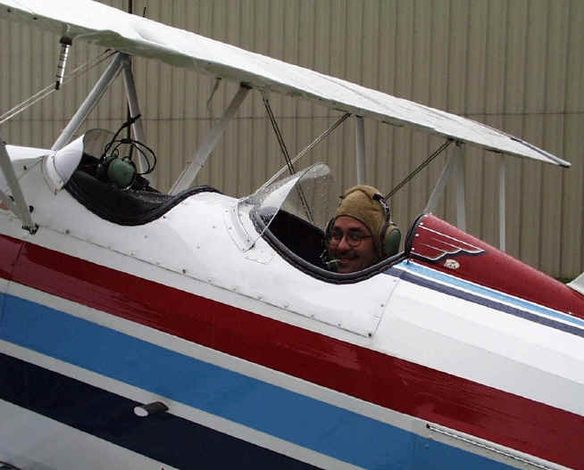
The visibility? Well
that’s the real clincher. The
biplane is soloed from the rear cockpit. The
reason for that is so the passenger can be placed directly over the center of
gravity thereby making the airplane balance at the same point regardless of
whether there is a passenger on board or not.
The downside to this brilliant design is that in the landing attitude
from the rear cockpit you can’t see ahead of you. In fact you can’t see the airport at all.
Even in cruise you’ve got somewhat restricted forward visibility but
landing takes downright faith. You
fly up to the airport, and slip the plane right or left to make sure you’re
over the runway. Then you raise the
nose to the landing attitude, and stare straight ahead (at the cowling) to use
some peripheral vision cues to try and track straight.
Remember how important it is to track straight?
The final part of the landing involves fully stalling the airplane right
at the moment of touchdown. Stall
too soon and you drop onto the runway like a manhole cover.
Wait too long to stall and the main gear touches first and puts you into
a dangerous bouncing situation called pilot-induced-oscillation.
So the trick is knowing when you are exactly an inch off the runway.
How? I couldn’t help but
keep hearing old Ben Kenobe moaning in my ear, “Use the force, Mike.”
I couldn’t have picked a more challenging airport to learn this in. Bayport is a 2100 foot long strip which makes it the second shortest place I’ve ever landed. Add to that the fact that it is ringed by trees, is made out of grass, is totally devoid of runway markings, has a stiff crosswind, and is raining and you’ll know why I had my work cut out for me. To add to the pressure, Bayport exists under a remarkably low 700 foot ceiling of controlled airspace. Climb one extra foot and you’ve just committed a federal offense. Ok, no pressure.
The first takeoff had the previous owner in the front
cockpit barking instructions to me over a noisy old intercom.
On our first climbout at say 500 feet he turns around to see if I’m
smiling. As he does the windflow
rips off his baseball hat and his headset. The
hat disappears and I reach out and catch the headset.
He reels it back in by the cord and gets it on his head.
I’m momentarily terrified to be startled at the command of an airplane
I can’t land, at a new airport, in the rain under a low controlled airspace
zone. He gets his headset back on and proceeds to tell me how
pissed he was at losing his hat. He
really liked that hat.
We did some airwork, including all kinds of stalls and some steep turns. He can tell that I’ve flown planes like this before and was quickly satisfied that I wasn’t going to kill myself in the air. Now to practice the landings. We went around and around the patch.
It was over 5 hours total in three flights trying to get
the landings right. I kept landing
too fast because it ‘feels’ safer. Instead of being able to just try a few
and dial in the sound and sight cues of the airplane, the instructor kept
telling me when to do everything. It
got pretty frustrating because eventually I was putting it down somewhat
consistently but never knew if I’d be able to do it without all the hints.
Of course you’re thinking, “why don’t you just ask him to be quiet
while you try and land it yourself?” Duh.
Didn’t work. Art’s a ‘vocal’
New York Italian type (sound like anyone you know?) This guy makes me seem autistic.
Anyway I ended up so frustrated with the instruction that I
decided to just set out and figure it out on my own. I had only slept a few hours the night before, I was hungry
and exhausted from a day’s worth of landing lessons. It seemed like the perfect time to set out West.
When I took off from Bayport the weather was clear and the sky was blue.
That’s when the leg happened that I wrote about first.
As I got out to sea and found that my GPS and radio weren’t working
right, the ceiling just suddenly started dropping. I’ve never seen fog form so fast. It was the same all around me – turning back was even
worse.
That night I had a beer with dinner. Best damn beer I’ve ever had.
Saturday 5/13 – The Westbound Adventure Begins
Farmingdale, NJ (BLM)
–> Leonardtown, MD (2W6)
-> Raleigh Durham, NC (RDU)
I started out the day saying, “let’s hope today is
better.” While waiting to take
off I did NOT see an omen. A big
black solitary bird perched on my upper wing in the midst of 600 foot ceilings
and 2 mile visibility in fog might have looked like an omen but I told myself it
wasn’t. I mean if I worried about
every possible omen and weather condition I was never going to get back, right?
The weather lifted just enough to be legal and we started
picking our way south along the east coast.
Crossing the Delaware River and the Chesapeake Bay were a little tense
– being out to sea with no land in sight was becoming one of my least favorite
things. I had to fly pretty low to
get anywhere in this weather and was remembering the advice of the instructor
– you always need to keep the nose moving.
You can’t see right in front of you.
I made shore and started weaving back and forth to see
where I was going. I was instantly
rewarded with a large red and white striped radio antenna tower at 12-o clock
and 2 miles. “That’s why they
put those damn things on the map” I thought out loud.
The noise from the airplane was starting to make my head
ring. At the next stop I tried to
buy earplugs from the fuel stop. I
must have said something wrong because the old guy at the desk just kept staring
at his book. Eventually I realized
I was trying to buy earplugs from a deaf guy.
Kind of ironic I guess. Turns
out he flew planes just like mine his whole life.
As the weather lifted up and I became more comfortable with
the plane I started having some real fun. Russell
and I would occasionally lose sight of each other and he’d call over the radio
for “smoke.” I’d open the valve and flip the switch and he’d easily spot
the fresh stream of white smoke in the blue sky.
It felt so nice to know that I had at my command a perfectly legal switch
that pumped raw oil right into the atmosphere.
That’s not just a byproduct of propulsion but pollution purely for the
sake of pollution. Now that’s
being free.
Coming into Raleigh I found the opportune time to start
practicing my slow landings. They
had a nice headwind and a huge runway so I told myself I would land it slow this
time. I had the nose high and was
doing a groundspeed of about 60mph. It
took several minutes to get all the way down the glideslope and onto the runway.
Once I touched down I saw a long line of DC9’s that had all been stuck
waiting for me to finish my beautiful slow-as-molasses style approach.
Each one probably represented a hundred people that had just wasted 10
minutes. I smiled.
We stayed overnight in Raleigh and saw Russell’s folks (they’re cool), had a nice dinner and did some laundry.
Sunday 5/14 – We’re flying now
Raleigh Durham, NC (RDU)
–> Morganton, NC (MRN) –>
McMinnville, TN (RNC) –>
Millington, TN (NQA)
Getting strapped into the plane is kind of a production.
You have to climb in, wiggle down, put in your earplugs, don the headset,
connect the headset, mic, and switch, fasten all five seatbelts, attach the
kneeboard, put the GPS on the kneeboard, attach the antenna, put the radio in
your pocket and stow your charts & gloves.
The only thing that makes this suck is when you realize that you just
forgot your radio antenna in your bag!
Just as I rotated off the runway at Raleigh a strap caught
my eye. It was the leather strap
attached to the zipper on the front cockpit cover. I had opened it the night before to show the front cockpit to
someone and guess I had forgotten to latch it.
It was flapping around violently and could probably damage something if I
ignored it. I waited till I was a
couple hundred feet up then leaned forward, reached my hand outside the cockpit
and with a swerve of the rudder blew the strap right into my hand!
I snapped it in place and sat back down – now I was flying!
Sunday was the first day that I could actually see the
horizon in front of the plane. I
had the legal minimum for visibility before but this was the first day you’d
actually call ‘a nice day to go fly.’
Warren County, Tennessee was such a quiet little airport
that the manager came out to meet us on the ramp. He said that is was unusual for someone to land here on a
Sunday. I went inside to get a coke
and saw a shirt for sale in the case, “The aviator and navigator club.”
I asked to buy one and the manager responded with a look of shock, “Are
you kidding? Nobody’s bought a
shirt here in years! I can’t
believe it! I mean, I don’t even
know what they cost – where’s the key? That club doesn’t even exist anymore, everyone in it has
either gotten lost or run into something!”
He spent the next ten minutes exclaiming to himself that I was buying a
shirt. We agreed on a price and I
put it in my bag. On my way out I
heard him telling someone on the telephone that two guys had just landed and one
bought a shirt. When he hung up he
told me that he was just talking to the editor of the local paper. I think he was serious!
Of the whole trip the Warren County airport had the coolest
airport car – an old Chevy Caprice cop car with the extra spotlight.
Instead of an air conditioning panel it had a sign that said “Don’t
lock the doors because we lost the key. Hey,
what did you expect from an airport car anyway?”
On my way out of Warren County I noticed fuel streaming out
of an inspection cover on my upper wing. I
watched it for a while and Russell & I figured out that it was just some
overflow from having had the tank filled on a non-level surface.
I wasn’t going to be totally comfortable with that explanation until I
landed and took the inspection cover off for myself.
Turns out I didn’t have to wait that long – as if by thinking it the
inspection cover popped off and flew away revealing a nice dry wing inside. “Oh,
thanks!” I said with a smile!
I had some trouble getting into Millington airport because
I was having trouble making radio contact with the tower.
Being an airport with Class D airspace requires two way radio contact
before getting within 5 miles or so of the runway.
Russell relayed my weak calls to the tower and they cleared me in.
After landing I went up to the tower controller to thank him for helping
me out. If you’ve never been
inside an airport tower you might think it is filled with radar screens and
those clear glass screens that people are always drawing on with grease pencils
in submarines. In reality you’ll
see an old federal-looking room with a TV blaring some football game, some
emergency light guns hanging from the ceiling, and a single large radio console
that sported an old style handset and a rotary (as in rotary phone) dial!
I finally found something less equipped than my airplane!
The airport manager drove us to the hotel himself and shared some stories about the airport’s busy seasons. Other than a dwindling stream of military activity the airport is only really used for airshows and traffic for the local NASCAR events. We got to learn all about NASCAR drivers and it seems that the majority of them are real jerks.
Monday 5/15 - Desert flying begins
Millington, TN (NQA)
-> Hot Springs, AR (HOT)
-> Sherman Denison, TX (F39)
-> Olney, TX (ONY) -> La
Mesa, TX (2F5)
By this point things are becoming pretty routine.
We’re making progress and knocking out four or more legs per day.
Russell’s plane is almost wrecked by an unmanned runaway fuel truck at
Hot Springs. I saw it rolling,
jumped inside and tried to pump the brakes.
The brake pedal went to the floor – NO BRAKES!
Oh wait – that’s the clutch. Ok,
here’s the brake. The truck
stopped a good foot and a half from his wing.
No splinters, no foul.
I managed to drink a coke in the air in between Hot Springs
and Texas. Trick #1 – opening a
can of coke in an open cockpit plane guarantees instant turbulence.
The last leg into La Mesa was an interesting one because my
electrical system on board the aircraft died (I had inadvertently hit the
alternator field switch during the flight) and we landed just after sunset in
the wake of a huge desert thunderstorm.
That was the first thunderstorm they’ve had in a year (only 5 inches of
rain have fallen on La Mesa in the last two years) and it had to happen right at
sunset right next to the only airport within 50 miles.
Squeaked by that one!
The guy that picked us up worked at the airport mixing
chemicals for crop dusting. Can you
say instant cancer? He was nice
enough to drag our gear and us into town to the shadiest motel of the entire
trip but we had to throw our stuff in the back of the truck on the bed of hay
and cattle feed. It made our Land’s
End and Columbia gear not look so “outdoorsy” in comparison.
At the motel you had to pay in full up front and then the
desk clerk (who clearly lived in a room attached to the front counter) gave you
a towel. “Have fun” he told us.
I had thought the hotel we stayed at in Tennessee was a dive because the
alarm clocks were chained down with cable.
This place took the cake – no alarm clock at all.
I had a bad feeling though if I really wanted to I could have borrowed
one (or an egg timer for that matter) from the front desk…
We learned that the natives call La Mesa the “Place where the dust blows.” How observant. At the restaurant attached to the seedy dive of a motel was a table with a sign overhead proclaiming “The Table Of Knowledge” because some group of old guys sit there every single day and have coffee all morning. I was thinking if they really had some knowledge they would have moved by now. In the lobby of the restaurant was an advertisement for a horse chiropractor. “Equine alignment center results in a happy horse.” No kidding. They even claim that it is gentle, “no mallets used.” Time to get out of here.
Tuesday 5/16 – Stopped by the wind
La Mesa, TX (2F5)
-> Carlsbad, NM (CNM)
This is where we got stuck. I mean I thought I was running late back to work before this but our stay in Carlsbad really took the cake. Getting into Carlsbad wasn’t too bad but the winds were getting gusty. Checking the weather they were just getting worse along the route westward. In places there was wind at 30 knots gusting to over 50 knots. Even if I could have possibly landed in those winds (which I couldn’t) I wouldn’t have the range or speed to even make it to the next airport. The next airport was 200 miles away. We sat. We realized after a while we’d be there for some time so we went to Carlsbad Caverns and saw the cave.
We then drove around town and learned that other than the caves there is nothing to do in Carlsbad.
Wednesday 5/17 – Webless in Carlsbad
If there was a low point on the trip it was here.
Being out to sea in near zero visibility was at least interesting –
being stuck in Carlsbad for two whole days was pure torture.
Russell and I went through the bookstore, and went to the library.
I read all the magazines in the Carlsbad public library and Russell
enjoyed his hour on the Internet. See
it is Carlsbad Public Library law to only let people use the web for one hour a
day – by previous appointment and only after having taken the instructional
course and signed the waiver. Information
is a dangerous thing out in the desert.
The wind howled all day.
Thursday 5/18 – Progress again!
Carlsbad, NM (CNM)
-> Santa Teresa, NM (5T6)
-> Lordsburg, NM (LSB) ->
Tucson, AZ (TUS)
We found a tiny window in the wind picture at 4:30am
Thursday morning so we blasted out of there in the dark.
I don’t have lights in the plane so I sat on a flashlight to read the
map.
At Santa Teresa we met Gene from Gene’s flying service.
He’s a nice guy. At Lordsburg we saw the first Cessna 172 ever made.
Then, coming into Tucson I started to get happy again – I was in
familiar territory and only a couple days from Seattle.
On final approach to Tucson International I was told to maintain 4500
feet and not to mind the F16’s practicing a formation break right underneath
me. The military jets passed within 200 feet of me and I could
see the pilots clearly through the canopy.
That was super cool. Too bad
I was out of smoke oil at this point.
Friday 5/19 – Time to get home
Tucson, AZ (TUS)
-> Buckeye, AZ (BXK) ->
Palm Springs, CA (UDD) -> Los
Angeles, CA (WHP) -> Madera,
CA (MAE) -> Chico, CA (CIC)
This was certainly the day of big progress.
I was in the air from 6am to past 8pm.
It was exhausting but still really fun.
The worst part was definitely flying through the Palm Springs area being
mercilessly thrown around in the cockpit by desert thermals and dust devils.
Ordinarily in a lightplane this is uncomfortable but when the only thing
keeping you from flying right out of the airplane is a single seatbelt latch it
can be downright terrifying! I must
have checked that latch a hundred times while battling the desert air.
By this time Russell and I had worked out a system where we
would take off together and he would speed ahead to the next fuel stop.
By the time I got there he was fueled, the fuel truck was ready for me,
and the next leg was already planned out. With
this preparation we got our fueling turnaround time to under 30 minutes.
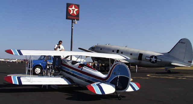
We landed at Madera to find an airshow in progress.
It was a bummer that we couldn’t stay because we were invited to put
our airplanes on the line to be judged. I
was really proud of the plane and the airshow photographer even took some
pictures of me with it to add to the collection.
I gave the crowd my best airshow-style high-speed low-altitude turning
takeoff. Amazing how much you can
learn about an airplane in only a week!
When we finally got to Chico I was ready to collapse. We’d been flying for so far and had covered so much ground that I welcomed the sunset. We happened to pick ‘graduation weekend’ in Chico which means that every hotel has been booked for up to a year in advance. Russell manages to find one place that had a last minute cancellation (final exam problem?) and we snuck into the only room in town at the Matador Hotel. I don’t know if I could have flown another mile.
Saturday 5/20 – We finally make it!
Chico, CA (CIC)
-> Medford, OR (MFR) ->
Aurora, OR (UAO) -> Renton,
WA (RNT)
I forgot my sectional chart as I climbed out of Chico so I
had to guess my way through the Mt. Shasta area. I kept guessing and climbing until I was at the point where
my nose wanted to turn blue from the cold.
“High enough,” I figured. We
made it into Medford with little problem but forecasts of IFR conditions to the
north had us stuck.
The weather briefing computer at Medford has a magic 8-ball on a chain connected to the desk. “Outlook not so good” it told me. I know – I hadn’t had luck logging in all week.
Once conditions lifted we made it to Aurora (Russell’s engine gave him a little scare along the way) and then picked our way through typical Seattle rain showers to get back to Renton. The weather was bad enough to go ‘open cockpit IFR’ (I Follow Roads). Flying open cockpit in the rain is like going through a carwash with the top down. Damn I was happy to get back.
Summary Statistics
- Getting to New York took 19.5 hours
- Getting back from New York took 49.2 hours (just for comparison – it took me 40 hours to earn my private pilot’s license in the first place)
- I used 336 AA batteries
- It took 25 flights to get back
- I burned 396 gallons of av-gas, 6 quarts of aviation oil, and 3 gallons of smoke oil
- Best progress was on the 19th with 9.4 hours flight time and almost a thousand miles covered
- Number of times Russell had to hand start my airplane because my starter broke - 5
- How much did the trip cost? Cardinal rule in aviation – never add up the cost!